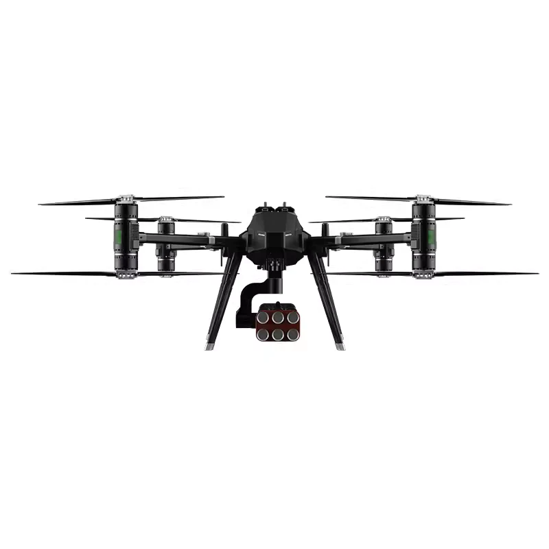
The Labhak AeroSurvey Pro is a professional Surveying & Mapping Drone. Features LiDAR, RTK GPS, and a 4K zoom camera for accurate data capture.
Labhak AeroSurvey Pro: Unleash the Power of Precision Aerial Data
The Labhak AeroSurvey Pro is a cutting-edge aerial platform engineered to deliver unparalleled accuracy and efficiency for a wide range of professional applications, including:
-
Land Surveying: Create highly detailed topographic maps, digital elevation models (DEMs), and orthomosaics with centimeter-level accuracy.
-
Construction Monitoring: Track progress, measure volumes, identify potential issues, and improve site safety.
-
Infrastructure Inspection: Inspect bridges, power lines, pipelines, cell towers, and other critical infrastructure quickly and safely.
-
Precision Agriculture: Generate NDVI maps, assess crop health, and optimize resource management.
-
Mining & Quarrying: Perform volumetric calculations, monitor stockpile levels, and conduct site surveys.
Key Features & Benefits:
-
Unmatched Accuracy with RTK GPS: The integrated Here 3 + RTK Base station provides real-time kinematic (RTK) positioning, achieving centimeter-level accuracy in your data without the need for extensive ground control points (GCPs). This significantly reduces field time and improves overall efficiency.
-
High-Resolution Imaging: The SIYI ZR10 Hybrid Zoom Gimbal Camera captures stunning 4K video and high-resolution still images. The 10x optical zoom allows for detailed inspection of hard-to-reach areas, while the HDR Starlight Night Vision ensures excellent performance even in low-light conditions.
-
LiDAR for Precise 3D Mapping: The Benewake TFMini Plus LiDAR sensor provides accurate distance measurements, enabling the creation of dense point clouds for detailed 3D models. This is crucial for applications requiring precise volumetric calculations and terrain analysis.
-
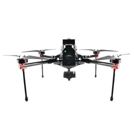
Robust & Reliable Flight Platform: Built on the durable TAROT Iron Man 650 foldable quad-copter frame, the AeroSurvey Pro is designed for stability and reliability in demanding environments. The foldable design allows for easy transport and storage.
-
Long Flight Time & Extended Range: Powered by high-capacity TATTU 10000mAh 6S 25C LiPo batteries and efficient T-Motor Antigravity MN5008 motors, the AeroSurvey Pro offers extended flight times, allowing you to cover larger areas on a single charge.
-
Advanced Flight Control: The New Cube Orange Plus FC Hex flight controller provides precise and stable flight performance, ensuring smooth data acquisition.
-
Smart & Autonomous Operation: The SIYI MK15 Smart Agriculture FPV Combo allows for intuitive control and monitoring of the drone, with features like waypoint navigation and autonomous flight modes.
-
Durable and Efficient Propulsion: The Hobbywing Skywalker 80A UBEC ensures reliable power delivery to the motors, maximizing efficiency and flight time.
Technical Specifications:
-
Flight Controller: New Cube Orange Plus FC Hex
-
GPS: HERE 3 + GPS Module with RTK Base Station
-
Camera: SIYI ZR10 Hybrid Zoom Gimbal Camera (4K Video, 10x Optical Zoom, HDR Starlight Night Vision)
-
LiDAR Sensor: Benewake TFMini Plus LiDAR (12m Range)
-
Frame: TAROT Iron Man 650 Foldable Quad-copter Frame (TL65B01)
-
Motors: T-Motor Antigravity MN5008 KV340 (x4)
-
ESC: Hobbywing Skywalker- 80A UBEC (x4)
-
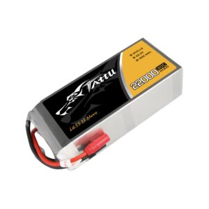
Battery: TATTU 10000mAh 6S 25C 22.2V LiPo (x1) Recommend purchasing multiple batteries for extended operation.
-
FPV System: SIYI MK15 Smart Agriculture FPV Combo
-
Assembly: Fully Assembled and Tested by Labhak Drones
What’s Included:
-
Fully Assembled Labhak AeroSurvey Pro Drone
-
SIYI ZR10 Hybrid Zoom Gimbal Camera
-
HERE 3 + RTK Base Station
-
TATTU 10000mAh 6S 25C 22.2V LiPo Battery (x1)
-
SIYI MK15 Smart Agriculture FPV Combo Transmitter and Receiver
-
Benewake TFMini Plus LiDAR Sensor
Contact us:
FAQs:
-
Q: What is the maximum flight time of the Labhak AeroSurvey Pro?
-
A: Flight time depends on factors like payload, wind conditions, and flight style. Under optimal conditions, you can expect approximately [20-25 minutes] per battery. We recommend purchasing additional batteries for longer missions.
-
-
Q: What is the range of the LiDAR sensor?
-
A: The Benewake TFMini Plus LiDAR has a detection range of up to 12 meters.
-
-
Q: What software is compatible with the data collected by the drone?
-
A: The AeroSurvey Pro generates data compatible with industry-standard photogrammetry and point cloud processing software, such as Pix4Dmapper, Agisoft Metashape, DroneDeploy, Global Mapper, and others.
-
-
Q: Does the drone require ground control points (GCPs)?
-
A: Thanks to the integrated RTK GPS, the AeroSurvey Pro can achieve centimeter-level accuracy without GCPs in many situations. However, for the highest absolute accuracy, or in areas with poor GPS signal, we still recommend using a few GCPs for verification and refinement.
-
-
Q: What kind of training is required to operate the drone?
-
A: While the AeroSurvey Pro is designed for ease of use, we recommend that operators have a basic understanding of drone operation and safety regulations. You are also responsible for complying with all local drone regulations.
-
-
Q: Is assembly required?
-
A: No the drone is assembled and automation charges are paid.
-